Two Boston Neighborhoods and the Wrecking Ball: The Lost West End and the North End That Survived
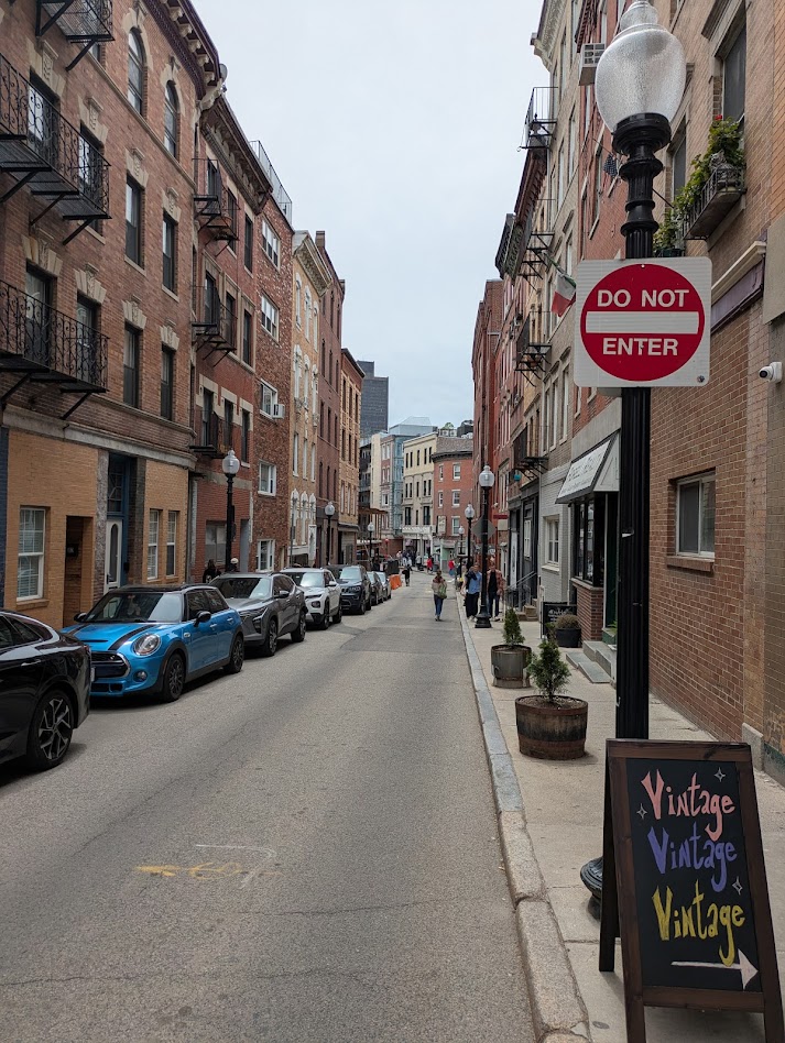
Walk the streets of Boston’s North End today and you are experiencing one of the oldest continuously inhabited neighborhoods in America.
Narrow brick streets wind between 4- and 5-story apartment buildings. Church steeples rise above rooflines. Corner shops occupy ground-floor storefronts that have held businesses for a century or more. It is dense, human-scaled, and largely intact, the kind of urban fabric that cities across the country spent the postwar decades destroying.
But less than half a mile away, that destruction happened anyway.
The West End: A Working-Class Neighborhood Declared a Slum
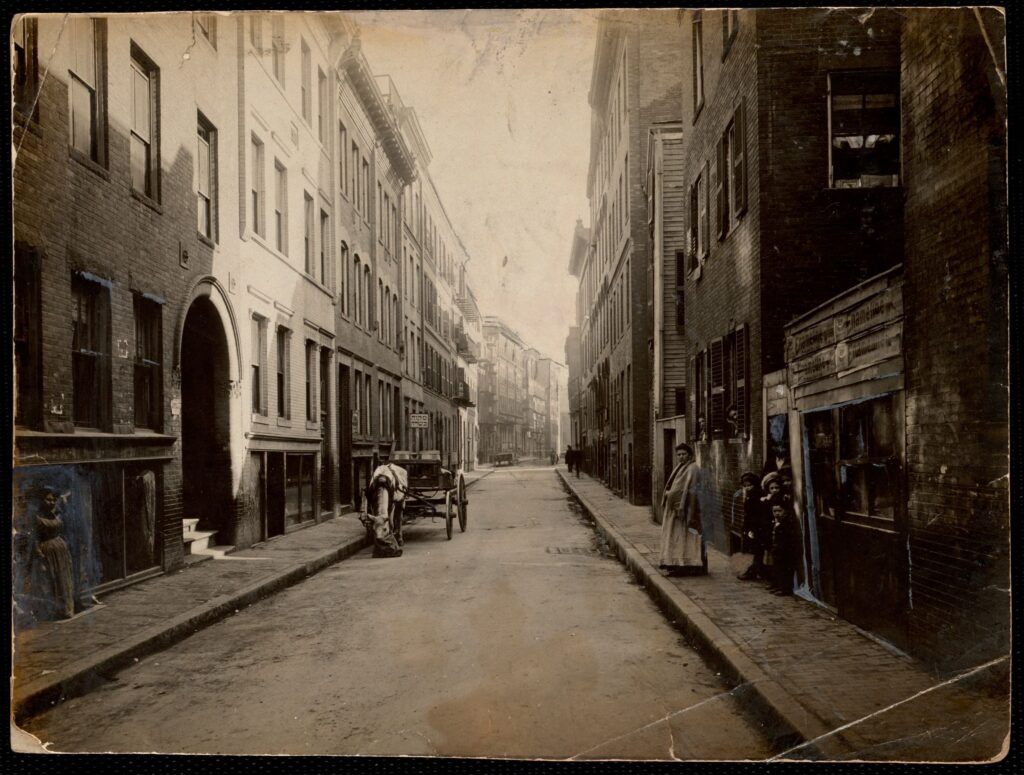
The West End sat just north of Beacon Hill, separated from the North End by a short distance and sharing nearly everything else: the same brick tenement architecture, the same dense street grid, the same working-class immigrant character.
By the early twentieth century it was home to Eastern European Jews, Italians, Irish, Poles, and African Americans living in close proximity — what one account called a neighborhood where “the hope of America’s melting pot perhaps came the closest to fruition.” (Segregation by Design) Actor Leonard Nimoy grew up there. President John F. Kennedy visited the West End House, a community club that served immigrant boys. (Wikipedia, “West End, Boston”; Boston Preservation Alliance)
Residents received their eviction letters on April 25, 1958. The Boston Redevelopment Authority used the Housing Act of 1949 to raze the West End to the ground. Working-class families were displaced, and superblocks replaced the original street layout. The BRA had declared the neighborhood blighted, a designation residents contested and a later mayor would describe as simply wrong.
A later mayor of Boston, Ray Flynn, described the West End as “a typical neighborhood” and “not blighted.” The campaign to label it a slum was deliberate: working-class residents of the West End were encouraged to view their neighborhood as a slum, and that message was promoted via comic books distributed to public school children, among other methods. (Boston.gov)
Over 300 buildings were demolished across 46 acres, effectively erasing a historically significant working-class immigrant enclave from Boston’s map. (West End Museum) The promised affordable replacement housing never materialized. Fifteen years after the demolition began, the only residential buildings that had been constructed in the West End were six luxury apartment towers, not the kind of housing the former residents would have been able to afford. (Boston.gov) Approximately 40% of former residents suffered from severe long-term grief reactions. In 2015, the Boston Redevelopment Authority officially apologized for what it had done.
How the North End Survived Urban Renewal
Boston’s North End is the city’s oldest residential neighborhood, inhabited since the 1630s and home to some of America’s most significant Revolutionary War landmarks, including Old North Church, the oldest standing church in the city built in 1723, where two lanterns hung in the steeple on April 18, 1775 signaled Paul Revere’s midnight ride.
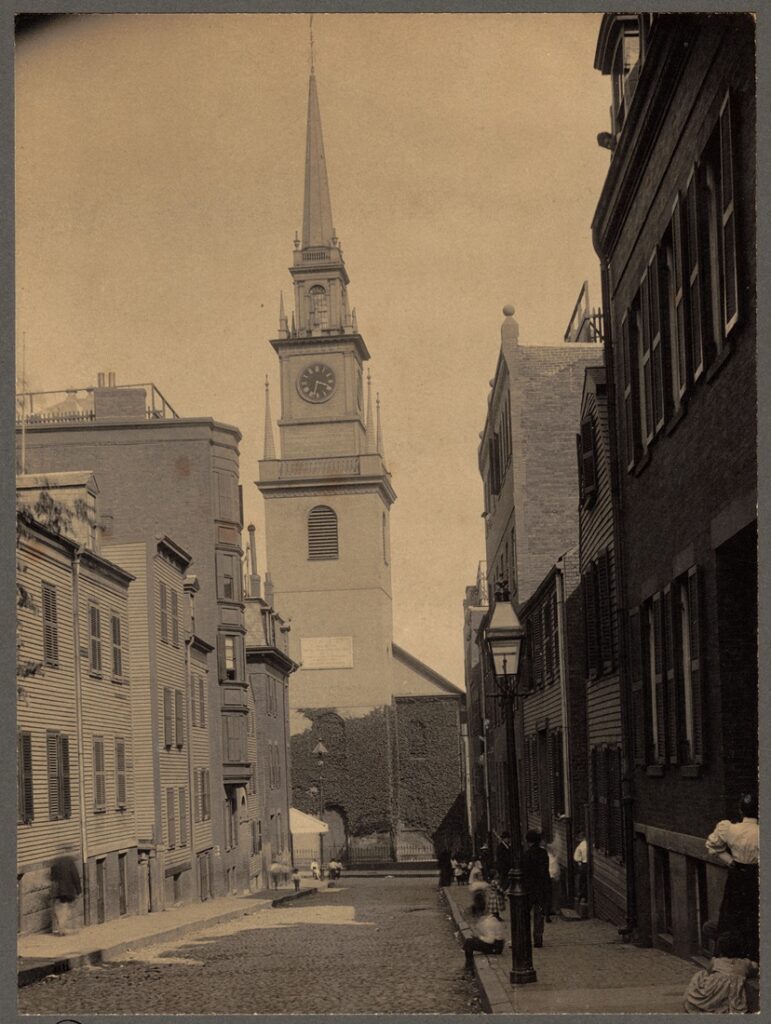
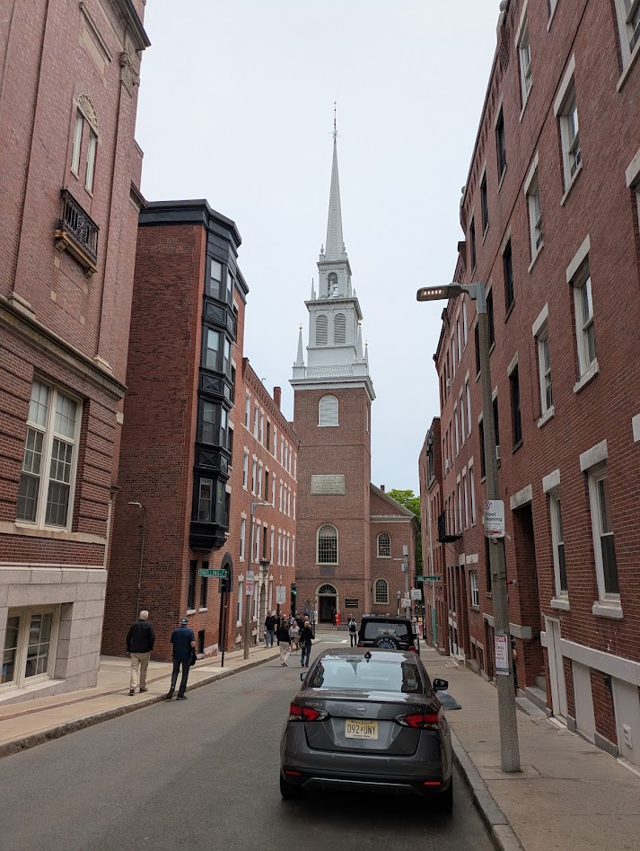
Through the 19th century the neighborhood absorbed successive waves of Irish, Jewish, and Italian immigrants.
By the early 20th century it was Boston’s Little Italy, home to as many as 44,000 Italian Americans at its peak, living in the dense brick tenement buildings that still line its narrow streets today.
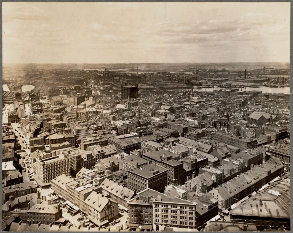
Historic photographs of the North End show streets that look remarkably similar to what stands there today, and remarkably similar to what the West End looked like before the bulldozers arrived.
Cooper Street. Fleet Street. Salem Street with the steeple of the Old North Church rising at the end of the block. The fire escapes, the brick facades, the narrow widths that force pedestrians and cars into an uneasy but workable coexistence.
It’s important to note, however, that the North End’s survival through the urban renewal does not mean that it completely avoided major losses and disconnection.
In the 1950s, the same decade the West End was being demolished, the John F. Fitzgerald Expressway, the elevated Central Artery, was built directly along the western edge of the North End to relieve Boston’s traffic congestion. Hundreds of North End buildings were demolished below Cross Street to make way for it, and the elevated highway physically walled off the neighborhood from downtown Boston, isolating it for half a century.
What the North End kept was its interior fabric: the narrow streets, the tenement buildings, the street life. What it lost was its connection to the rest of the city.
It wasn’t until the Big Dig, the massive infrastructure project that buried the Central Artery underground between the 1990s and early 2000s, that the North End was finally reconnected to downtown Boston. The Rose Kennedy Greenway now runs where the elevated highway stood.
Beyond the highway project, the North End survived the urban renewal era for several reasons. Some would point to the fact that its Italian-American community was politically organized and protective of its neighborhood. The neighborhood also had cultural and historical significance, including Paul Revere’s house, Old North Church, Copp’s Hill Burying Ground, that made wholesale demolition harder to justify.
And the failures of urban renewal became visible early enough that the appetite for repeating them was diminished. The West End’s destruction, which proceeded with “remarkable and brutal efficiency” between 1958 and 1960, served as a warning that other Boston neighborhoods did not ignore. (West End Museum)
The North End today is one of the most densely populated and expensive neighborhoods in Boston. The same density that once made neighborhoods like it targets for urban renewal planners, the crowding, the mixed uses, the absence of parking and setbacks and lawns, is now understood as a feature rather than a defect.
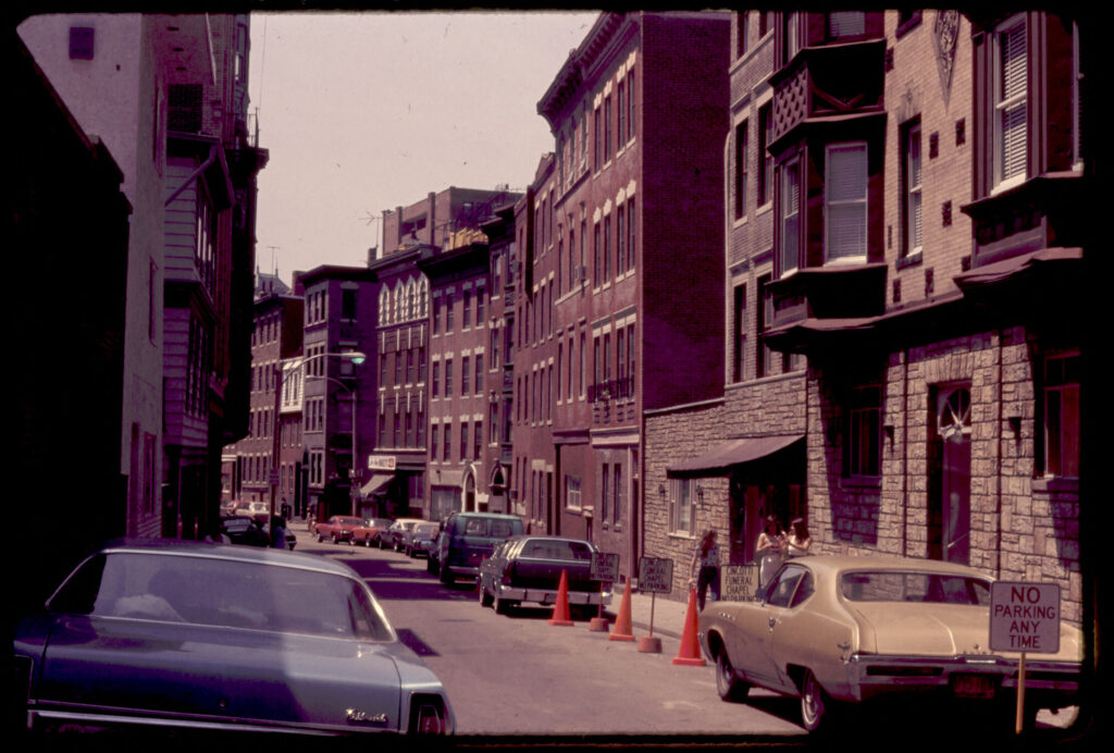
Jane Jacobs, whose 1961 book The Death and Life of Great American Cities drew extensively on neighborhoods like the North End to argue against the planning orthodoxies of the postwar era, visited in 1959, describing streets “alive with children playing, people shopping, people strolling, people talking.” She also used the West End as a cautionary example of what happened when planners prioritized abstract notions of order over the messy vitality of actual urban life.
What’s Left of the West End and the West End Museum
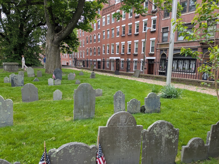
A handful of West End buildings survived: the Bulfinch Triangle, a few institutional structures, one or two tenements on the edges of the clearance zone. The West End Museum, opened in 2004, occupies a small space near the site of the old neighborhood and tells its story through photographs, oral histories, and artifacts. Former residents still publish a newsletter with the tagline: “Printed in the Spirit of the Mid-Town Journal and Dedicated to Being the Collective Conscience of Urban Renewal and Eminent Domain in the City of Boston.”
But the dense brick apartment buildings, the corner stores, and the cohesive community feel, are long gone.
What a difference half a mile and a single planning decision made.
Sources:
- Boston.gov, “The demolition of the West End,” by Anna Boyles, March 2020 — https://www.boston.gov/news/demolition-west-end
- Boston.gov, “The West End: Slum or bustling urban neighborhood?” by Noah Cabral, April 2020 — https://www.boston.gov/news/west-end-slum-or-bustling-urban-neighborhood
- West End Museum, “Urban Renewal in Boston’s Charlestown Neighborhood and Lessons Learned from the West End,” May 2025 — https://thewestendmuseum.org/history/era/immigrant-neighborhood/urban-renewal-in-bostons-charlestown-neighborhood-and-lessons-learned-from-the-west-end/
- West End Museum, “The Last West Enders” — https://thewestendmuseum.org/history/era/new-boston/the-last-west-enders/
- West End Museum, History overview — https://thewestendmuseum.org/history/
- Boston Preservation Alliance, “The West End: What We Will Lose,” August 2022 — https://www.bostonpreservation.org/news-item/west-end-what-we-will-lose
- Segregation by Design, “The West End” — https://www.segregationbydesign.com/boston/the-west-end
- Next City, “Will Urban Renewal Ever End?” August 2016 — https://nextcity.org/features/boston-city-hall-urban-renewal-redevelopment-authority
- The Justice, “Boston’s West End: The spirit of a neighborhood destroyed,” April 2025 — https://www.thejustice.org/article/2025/04/bostons-west-end-the-spirit-of-a-neighborhood-destroyed
- Boston Hidden Gems, “Boston’s North End” — https://www.bostonhiddengems.com/blog/gpidjzzza6mkgpxvbj7a7rjawbm2og
- Old North Church, “Our History” — https://oldnorth.com/our-history/
- Jane Jacobs, The Death and Life of Great American Cities (1961)