From Fertilizer Plant to Bird Sanctuary: Cleveland’s Puritas Wetland and Green Infrastructure
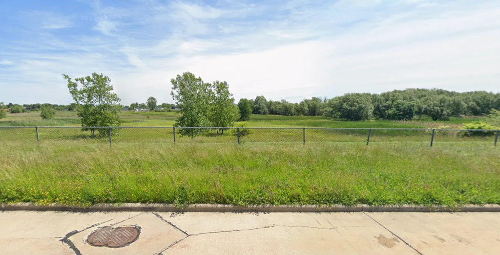
On the west side of Cleveland, tucked between residential streets and Interstate 480, there is an 80-acre wetland that people who live nearby have never visited, as there is no public access. Birders know it well, however. They park along West 145th Street facing north and scan the area from behind a chain-link fence. They walk Industrial Parkway from 150th Street, peering into willow stands where warblers shelter during migration.
This is the Puritas Stormwater Detention Basin. It wasn’t intentionally created to be a nature preserve, however. It was designed to keep residents’ basements from flooding.
Cleveland’s Combined Sewer Problem and Lake Erie
Cleveland’s oldest neighborhoods were built with combined sewer systems: single pipes carrying both sewage and stormwater to treatment plants. The design made sense when it was built, but has a fundamental weakness: during heavy rain, the volume overwhelms the pipes, and the combined overflow discharges untreated water directly into local waterways and ultimately Lake Erie.
In the 1970s, more than 9 billion gallons of combined sewage reached Lake Erie every year from Cleveland’s system alone (NEORSD).
A stormwater detention basin captures that runoff, holds it temporarily, and releases it slowly at a rate the system can handle.
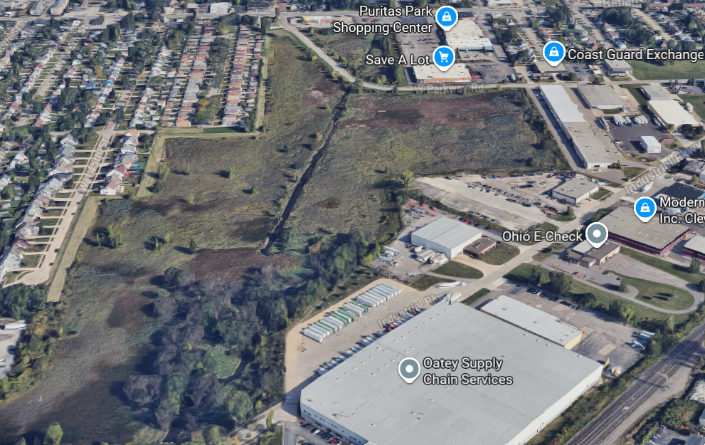
This is the purpose of the Puritas basin, fed by a channel engineered to direct stormwater away from adjacent properties and I-480. (Birding Hotspots, Puritas Wetland).
That part was intentional, but nobody planned for the extent of what would eventually grow in the basin alongside its stormwater features.
From Marshland to Agrico Fertilizer to Puritas Wetland
The area around what is now the basin was formerly a fertilizer plant, but historically was marshy land and the site of a pond fed by the Big Creek watershed (West Park History, “Dryer’s Pond”).
The American Agricultural Chemical Company, locally known as Agrico, opened on the site in 1874 and operated until around 1970. (West Park History)
When the plant closed, the land passed to the City of Cleveland and was repurposed for stormwater management.
And subsequently, a gradual ecological transformation brought the site back to its natural character, creating conditions where native plants could establish and in turn fostering habitat for birds and other wildlife.
Surveys conducted by the Cleveland Museum of Natural History beginning in 2005 have documented more than 138 bird species on the site, including several listed as endangered in Ohio, and more than 66 native plant species (Cleveland Water Pollution Control, 2017).
Cleveland’s Project Clean Lake and Green Infrastructure Efforts
The Puritas basin was one early piece of what became a much larger environmental effort in Cleveland.
In 2010, the Northeast Ohio Regional Sewer District entered a federal consent decree mandating a 98% reduction in combined sewer overflows into Lake Erie by 2036, from 4.5 billion gallons annually to 500 million (NEORSD, “About Project Clean Lake”).
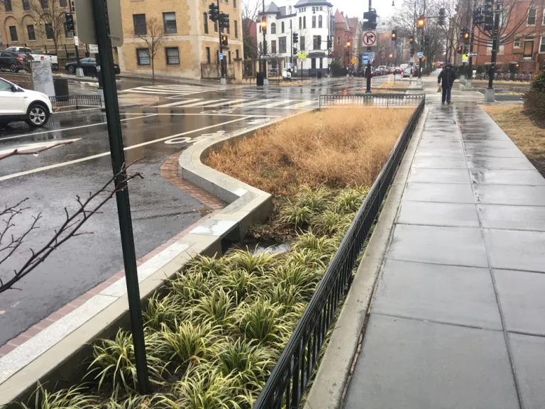
The resulting $3 billion program, Project Clean Lake, combines large underground tunnels with green infrastructure: bioretention basins, rain gardens, bioswales planted with native species, and permeable pavement spread across Cleveland neighborhoods.
Urban Bioswales on Cleveland’s Vacant Lots
The sewer district has also worked with the Cuyahoga Land Bank to turn vacant lots, left behind by Cleveland’s deindustrialization and subsequent population loss, into functioning stormwater features.
Bioswales are shallow planted channels along a street or in a vacant lot that slow and filter runoff before it reaches the sewer.
Cleveland’s 2010 consent decree was the first in the country to formally incorporate green infrastructure as part of a mandated pollution control plan (NEORSD).
The Cuyahoga River caught fire in 1969, an image that defined Cleveland’s environmental reputation for a generation and helped drive the passage of the Clean Water Act.
But in the decades since, there has been a sustained effort to reverse a century of industrial damage, in projects both big and small.
And the birders on West 145th Street, scanning the cattails through a chain-link fence, are watching a truly significant part of that effort.
Sources:
- Cleveland Water Pollution Control, “Stormwater Detention Basins Are Green Spaces Too,” 2017, https://www.clevelandwpc.com/sites/default/files/2020-09/Stormwater%20Detention%20Basins%20in%20Cle.pdf
- NEORSD, “About Project Clean Lake,” https://www.neorsd.org/community/about-the-project-clean-lake-program/
- US EPA, “Combined Sewer Overflow Frequent Questions,” https://www.epa.gov/npdes/combined-sewer-overflow-frequent-questions
- West Park History, “Dryer’s Pond,” http://www.westparkhistory.com/spotlight/DryersPond.htm
- Birding in Ohio, “Puritas Wetland,” https://birding-in-ohio.com/cuyahoga-county/puritas-wetland/
- Birding Hotspots, “Puritas Wetland,” https://birdinghotspots.org/hotspot/L857737